
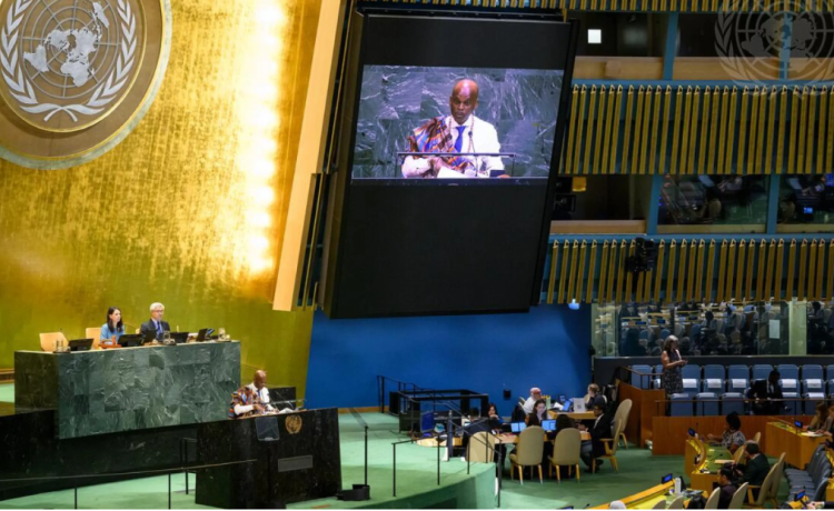
The United Nations General Assembly has overwhelmingly backed an African-led initiative calling for greater use of world maps that represent the true relative size of Africa and other continents. The resolution was led by Togo and the African Union and passed by 164 votes to 1, with six countries abstaining.
Why Africa looks smaller on traditional maps
The issue centres on the Mercator projection, a map created by Flemish cartographer Gerardus Mercator in 1569. The projection is useful for navigation because it preserves directions, but it significantly enlarges areas farther from the Equator.
As a result, Greenland can appear almost as large as Africa, even though Africa is actually about 14 times larger.
The distortion also makes parts of Europe and North America appear much larger relative to countries around the Equator.
Equal Earth projection promoted
The UN resolution encourages governments, schools, international organisations and technology companies to consider Equal Earth and other equal-area projections when showing the relative size of continents.
Equal Earth was developed to provide a more accurate representation of land areas. It does not make Africa physically bigger; instead, it removes much of the distortion created by traditional projections.
Togo leads the campaign
Togo has been at the centre of the campaign, working with the African Union to encourage countries to “Correct the Map.”
Togo’s Foreign Minister Robert Dussey has argued that maps influence how people understand the world and that Africa’s visual representation has been distorted for generations. Togo plans to introduce the new approach into its school geography materials before the end of the year.
The US votes against
The resolution received overwhelming support, but the United States was the only country to vote against it. Six countries — Estonia, Georgia, Lithuania, Moldova, Serbia and Ukraine — abstained.
The US representative described the initiative as part of what Washington considered a broader ideological agenda and argued that the UN should focus on other global challenges.
It does not ban the Mercator map
Importantly, the UN resolution is not legally binding and does not ban the Mercator projection.
Mercator remains particularly useful for maritime and aerial navigation, where its ability to preserve direction is valuable. The initiative is mainly focused on educational, institutional and public representations where accurately showing relative land size is important.
The decision has nevertheless been welcomed by African campaigners, who say accurate maps could help change long-standing perceptions of Africa and give students a more realistic understanding of the continent’s enormous geographical size.